
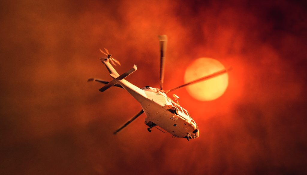
The world is facing more extreme and more frequent natural disasters — and engineers are among those on the front lines.
As climate change sets in, instigating more frequent — and often, more extreme — natural disasters, engineers are increasingly at the vanguard of efforts to blunt the onslaught and prepare communities to cope.
From flood predictions to fire behaviour research, it’s their technical expertise that can make the difference between life and death for those caught up in nature’s fury.
Disasters take lives and livelihoods, and a growing economic toll — $38 billion a year on average, a figure estimated to reach at least $73 billion per year by 2060, even with lower emissions, according to the National Emergency Management Agency (NEMA).
In the face of devastating fires and floods, the federal government set up the agency in September 2022 to better respond in times of disaster and plan for long-term preparedness and faster recovery.
While NEMA funds programs and initiatives, and provides round-the-clock all-hazards monitoring and operational coordination, it is engineers — as creative problem-solvers and systems thinkers — who are among those at the forefront of the fight against climate change.
Since the devastating “once-in-1000 year” floods in the Northern Rivers region of New South Wales in March 2022, Engineers Without Borders Australia (EWB) has engaged engineers, including individual professionals and employees of engineering firms Arup and Douglas Partners under pro bono programs, to assist residents with geotechnical assessments, advice on waterway crossings and the structural assessment of buildings.

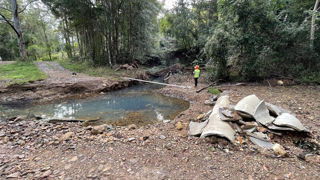
CEO Eleanor Loudon said EWB was approached by Lismore-based non-profit Holding Hands Underground for engineering support and more than 100 households registered for help.
“These have concerned everything from washed-out creek beds and waterways to internal roads and multiple occupancy housing,” she said.
“We have deployed civil, structural and environmental engineers, and are looking for funding to continue to assist people who are falling through the cracks.”
With concerns in the region about rebuilding ahead of another possible flood, Loudon said advice on retaining walls or raising houses has been in demand.
Engineering volunteers conduct site visits, scope management plans and deliver options reports for each affected household.
This is essential in expediting the repair and restoration process, and to reduce the prolonged delays that communities are experiencing — improving the lives of residents, increasing economic stability and improving public safety, said Loudon.
Further afield, in Vanuatu, EWB engineers and Arup Australasia are implementing technical solutions and working on sector and systems-strengthening projects following cyclone activity.
Their Emergency Sanitation Guidelines, developed with Vanuatu’s Ministry of Health, won an International Philanthropy Award; these focus on designing sanitation that withstands natural disasters but also on sustainable and long-term change in partnership with government and local non-government organisations.
Loudon said one part of the project involved engineers developing composting toilets for higher-ground areas. They are now designing footbridges for areas that become inundated with water so children can get to school — “something UNICEF will look at scaling up if we get it right”.
Cyclones and storm surge
Bruce Harper CPEng FIEAust, director of Systems Engineering Australia and Adjunct Professor of Engineering at James Cook University, is a specialist civil engineer with more than 45 years of experience in coastal, ocean and wind engineering, including numerical and statistical modelling of extreme events.
“I’m an avid ‘modeller’ borne of the innovative James Cook University systems engineering initiatives of the 1970s,” he said.
“I developed Australia’s first storm surge model of tropical cyclones in the late ’70s and one of the very first insurance loss models in the mid-1990s that adopted GIS and Monte Carlo techniques to consider the impacts of tropical cyclone winds and storm surge, later extending to severe thunderstorm downbursts, hail and tornadoes.”
In 2005, Harper created the SEAtide prediction and analysis system, which enables tropical cyclone forecasters and emergency managers to rapidly evaluate the possible impact to coastal communities of storm tide and destructive wind threats.
“It provides an intuitive operating interface that is easy to learn and operationally efficient,” he said.
“A central map display is supported by a data browser and a wide variety of space and time graphical output.”
The SEAtide software was initially used by the Bureau of Meteorology before it developed its own Australia-wide system, and is still used by the Queensland Government.
It proved its accuracy during the Yasi Category 5 cyclone in 2011, which ploughed into the Cassowary Coast near Cardwell.
Harper’s validated Australia-wide synthetic 50,000-year tropical cyclone wind climatology has also been widely applied in the design of buildings, towers, and wind or solar farms.
The guidelines he developed for the World Meteorological Organisation have assisted tropical cyclone forecasters and researchers globally to convert intensity estimates into a common framework.
Among the recommendations were that forecasters and researchers ensure that the siting, instrument selection, sampling, processing, documentation and archiving of wind data automatic weather station networks are carried out in a manner that will ensure accurate estimation of the mean wind and its associated turbulence properties.
As a minimum, this includes the 10-minute averaged wind (or V600) and the three-second peak gust in each 10 minutes (known as V3600) — preferably including the one-minute average wind (or V60), said Harper.
“Where possible, we recommended that episodes of high wind — say, greater than 17m a second — should be recorded continuously at 10 Hz sampling to provide research-grade datasets.”
The research has since been widely adopted and has contributed to more standardised reporting of tropical cyclone intensity.
Harper tells create that as early as the 1970s, after Cyclone Althea swept across Townsville, there was an epiphany among engineers who realised building standards and regulations were a cottage industry and mainly council specific.
“There was a groundswell, accelerated by Cyclone Tracy [which hit Darwin on Christmas Day 1974, killing 71 and devastating 80 per cent of the city], and the Australian Wind Loading Committee completely revised its standard, with Australian buildings required to be capable of surviving a 1000-year return period windspeed.”
Even though that figure was later reduced to a 500-year return period, engineers see a lot of building damage that, according to the standards, shouldn’t happen.
“There is not much point engineers saying we know what the extreme windspeed might be if it’s not actually built to the standard,” he said. “Ultimately, regulation and inspection are at the heart of it. This is a major problem for community resilience going forward.”
Are we prepared for the next cyclone?
“It depends where it hits,” Harper said.
“The good news is that, with the increasing availability of satellite sensors and models, the forecasts are getting much better and, with mature storms, like Debbie, which characteristically emanate from far offshore, it’s now relatively straight forward for the Bureau of Meteorology to predict where they will go.”
However, the nationwide focus of climate disaster funding on recovery rather than avoidance is one that needs to change, Harper believes.
“The real crisis in this country is where the lack of historical foresight in flood planning is going to keep hurting us until real action is taken,” he said.
Water inundation
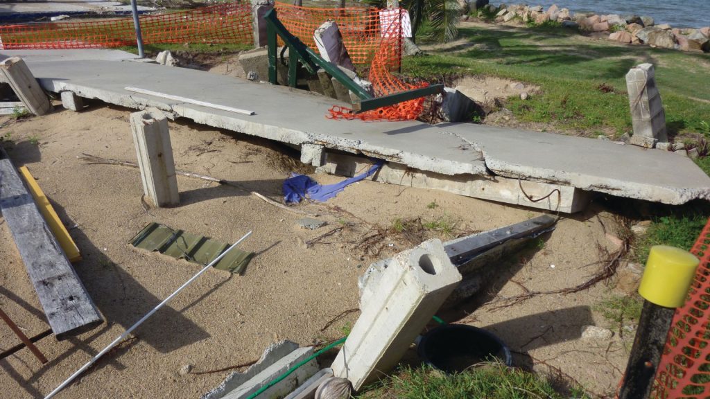
It’s been one year since the 2022 eastern Australia floods, which were estimated to be, at $9.6 billion, the costliest in the country’s history.
Environmental engineer Juliette Murphy CPEng, CEO and co-founder of FloodMapp, which provides real time flood intelligence for emergency managers, said a Productivity Commission inquiry into natural disaster funding found 97 per cent of that money went towards reconstruction and recovery, compared to only three per cent for mitigation and community resilience measures such as flood intelligence and early warning systems.
With increasingly severe flood events, Murphy believes we need more wide-scale investment — not just in the recovery stage of flood response, but early warning tools.
“While Lismore had some excellent flood risk studies and floodplain management planning done by local government and engineering consultants, these rely on a limited number of static flood risk scenarios based on climate and flood data we have observed historically,” she said.
“Climate change means that we are now seeing more frequent and more severe flood events, and we need to be able to expect the unexpected.
“Operational flood intelligence and early warning systems are crucial to support emergency managers in operationalising their flood risk management plans, particularly where events exceed all historical floods or modelled risk scenarios.”
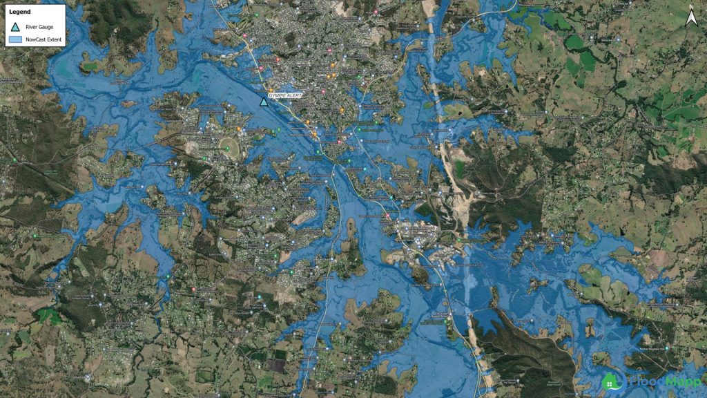
On a mission to reduce the impact of flooding and save lives, Murphy and her co-founder Ryan Prosser have developed mitigation solutions in FloodMapp — technology that provides scalable, real-time flood intelligence.
FloodMapp’s Dynamic Automated Scalable Hydroinformatics — or DASH — uses forecast and observed rainfall, river height and catchment characteristics to produce ForeCast, NowCast and PostCast.
The novel hydrology and hydraulic modelling technology was specifically developed for emergency management and combines traditional engineering principles with advances in automation and machine learning.
“FloodMapp delivers operational intelligence that supports emergency managers with a common operating picture, and situational awareness on asset-level flood impact to inform decision making and targeted response,” Murphy said.
To prove this, FloodMapp first worked with Queensland Fire and Emergency Services (QFES) in the State Disaster Coordination Centre (SDCC) during a March 2021 flood in the Logan Albert Catchment.
It not only accurately predicted the river peak, at an upper limit of 12.5 m, but produced a detailed inundation map of the impact.
“The forecast model was delivered digitally as a live mapping feed and ingested into the QFES Esri ArcGIS portal as a digital map,” Murphy said.
Data interoperability meant that the SDCC was able to overlay the map with its internal population and asset datasets to provide situational awareness of the potential flood impact to people, property and critical infrastructure — and plan for evacuation 24 hours before the flood occurred.
“It also facilitated a common operating picture with other disaster management agencies,” said Murphy.
“With this speed and level of accuracy, deployed as a shared situational awareness, QFES and the Queensland Police Service were able to rapidly pinpoint impacted properties and plan highly targeted, safe and timely evacuations and community messaging.”
FloodMapp technology is now used by such companies as Energy Queensland, Transport for NSW and Origin Energy.
But its largest government investment has come from the US Federal Emergency Management Agency, which will use Australian engineers to provide operational flood inundation and analytics data feeds, including assessment of potential damage to property.
Bushfire behaviour and preparedness
The world has witnessed an unprecedented scale and frequency of wildfires in the 2020s, especially in eastern Australia and the western United States.
In the latter, there were eight fires in 2020 alone, affecting 5.3 million ha from Alaska to New Mexico and costing US$3.3 billion.
Despite arduous efforts to improve our understanding of these catastrophic events, we are still far from unlocking the mysteries of their behaviour and their impact on ecosystems, communities and infrastructure, said Dr Alexander Filkov, a Senior Research Fellow at the University of Melbourne, who is determined to create a new paradigm for bushfire science and engineering.
A mechanical engineer and combustion scientist, his research focuses on better understanding dynamic fire behaviours, their influence on ignition and combustion of fuels, transition mechanisms of wildland fires into wildland-urban interface areas, and fire performance of structural materials.

As the co-leader of the Ignition Resistant Communities subgroup of the International Association for Fire Safety Science, and a board member of the International Fire Safety Consortium, Filkov collaborates with global experts to advance knowledge of large wildfires and their interactions with the built environment.
A current research project, in conjunction with UNSW, Victoria University, CSIRO’s Data61 and San José State University, focuses on understanding how fire lines merge together — a phenomenon that has critical implications for predicting the behaviour and spread of large bushfires.
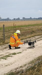
“A combination of experimental and computational methods — including lighting fire lines of different shapes in controlled environments and measuring their characteristics using unmanned aerial vehicles equipped with infrared and visual cameras — is used,” said Filkov.
“These capture high-definition video imagery of fire propagation in synchronisation with sensor data from the onboard GPS and inertial measurement unit.”
They have also developed a custom-built fire package capable of measuring radiative and convective heat fluxes inside the fire, which they tested during the 2022 prescribed burning experiments in Victoria.
“By combining these data with physics-based modelling using computational fluid dynamics, we hope to further understand the mechanisms driving extreme and mega fires” he said.
Another aspect of Filkov’s work that will contribute to fire preparedness focuses on exposure to fire brands — small, combustible fragments from an original fire — which are “responsible for at least 90 per cent of destroyed structures in wildland-urban interface fires”, he said.
He is leading a project in collaboration with the University of Maryland and the University of California Berkeley to determine the mechanism of ignition of building materials by fire brands and to identify key building material properties that define their propensity to ignite when subjected to fire-brand showers.
To achieve this, he developed a variable heat flux apparatus capable of simulating the dynamic radiant and convective exposures of fire.
“The knowledge gained from this project will help define critical conditions for ignition and sustained combustion of materials, and map firebrand safety zones around structures.”