

A fatal structural error and misinterpretation of computer modelling contributed to the collapse of this Singaporean MRT station 20 years ago.
Since its post-independence construction boom, Singapore has expanded its mass rapid transit (MRT) network to almost 150 locations as of 2024, with seven new stations being recently unveiled along the Thomson-East Coast Line – and more yet to come.
But the ongoing project’s impressive safety record was interrupted in 2004, when an underground MRT station under construction collapsed, injuring three people and killing four – one of whom was never recovered from the site.
With a suite of changes being instituted in the years following, the Nicoll Highway disaster forever altered the way Singapore approached construction.
What happened?
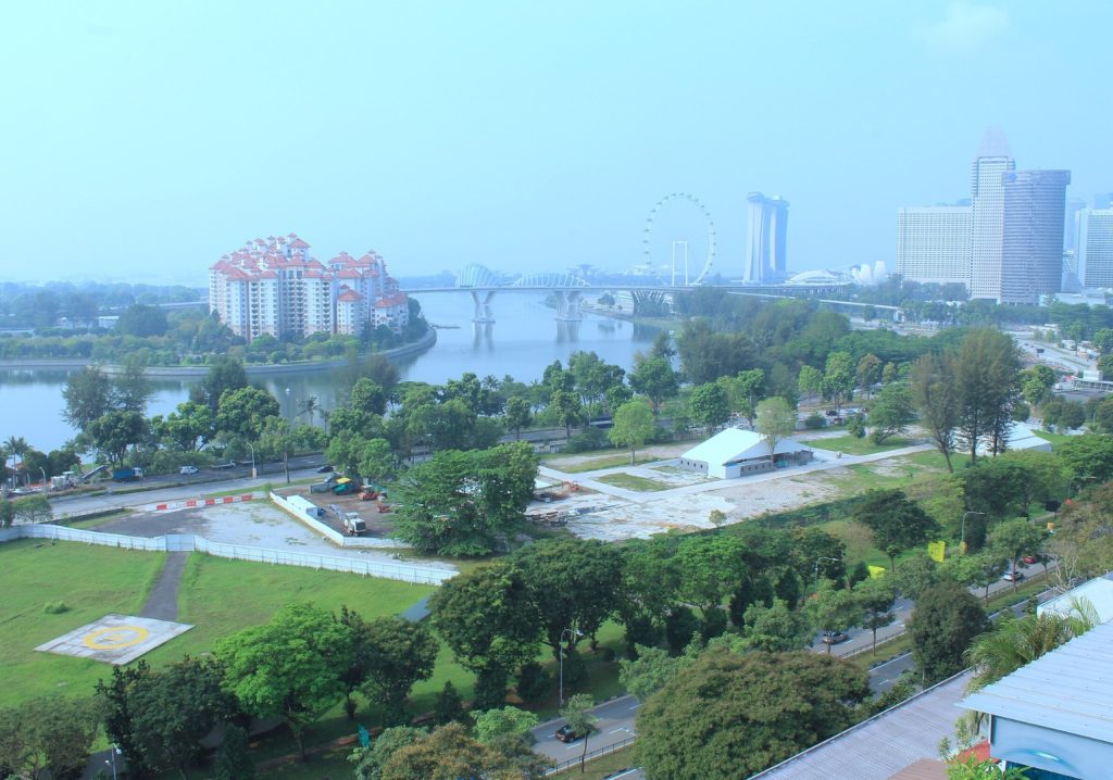
Nicoll Highway station, named for the bustling east-west thoroughfare that passes overhead, was to be built atop alluvial soil and a layer of soft marine clay 30 m deep.
Much of the country’s land had been reclaimed from the ocean, including the area surrounding Nicoll Highway, which was consolidated by placing dredged sand on top of the clay.
According to a 2015 report by the International Society for Soil Mechanics and Geotechnical Engineering (ISSMGE), the country had built multiple other underground MRT structures on reclaimed land.
Despite this, excavation works in soft clay as deep as 30 m had not been attempted.
“Consolidation under the fill [was] not fully complete and residual pore water pressures of up to 3 m were reported in 2004,” the report’s author LJ Endicott said.

During excavation, workers placed a pair of concrete diaphragm walls approximately 20 m apart which were supported by steel struts. On 20 April 2004, these walls converged, bringing down nine levels of steel strutting and causing the collapse of 80 m of the excavation.
“The ground outside the excavation subsided, forming a crater with a diameter of about 100 m and a maximum depth of about 13 m,” Endicott said.
What went wrong?
A government inquiry identified the following as the major factors contributing to the collapse:
- Errors in the design of the strut to waler connection
- Two erroneous back analyses
- Deficient monitoring at the site
- Incorrect use of the computer program
“In February 2004, two months before the collapse, at an adjacent section of the excavation there had been problems with the connection between the struts and the walers which led to retrofitting a modified stiffener to the waler,” Endicott explained. “At about the same time the basis of the design of the temporary lateral earth support system was seriously questioned.
“An expert for the Land Transport Authority (LTA) said that the computer program had been used incorrectly and that as a result the deflections and bending moments in the walling were [underestimated].”
As a result, the diaphragm walls “were weaker than they should have been”, Endicott said. Disagreements among contractors as to which of the models produced by PLAXIS was preferable meant that this was not identified.
What changed?
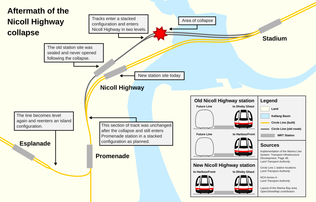
An MRT station was eventually installed at Nicoll Highway, but not at the original site; the station was constructed 100 m to the south, flattening the intended curve in the MRT line’s design.
The incident prompted the LTA to radically revise safety procedures, Endicott said.
“These are more specifically geared towards underground railway construction and include, in addition, details of global stability checks, full consideration of failure of one level of struts, the use of software and submission of both drained and undrained analyses, proper back analysis, as well as maximum allowable movements and assessment of buildings and utilities.”
The LTA also mandated that deep temporary earth retaining structures should reflect the same safety procedures as permanent works.

The Building and Construction Authority (BCA) called for a check on “all uses” of PLAXIS, the commonly used soil modelling software that was used during the project and contributed to a fatal underestimate of structural strength.