

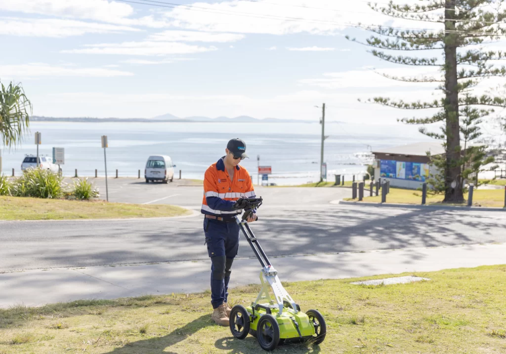

When engineering surveyor Jim Morrison was engaged to provide a detailed map of the utility infrastructure beneath a proposed 14 km bypass, he knew he’d need to find out exactly where the existing electrical cables, broadband connections, water supplies and sewer outlets were positioned.
It was a major undertaking for the Coffs Harbour-based operator, as many of these fixtures would either have to be repositioned to make way for the highway or overlaid with new power supply and water mains.
His biggest challenge, however, was the lack of locate information on the site in northern New South Wales, which would tell him everything he needed to know.
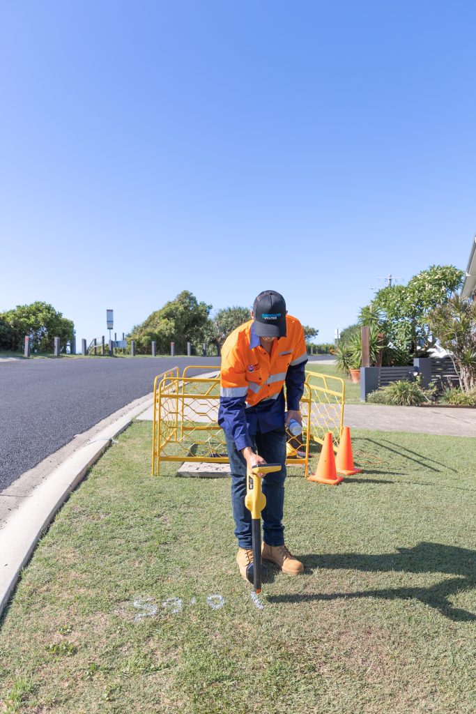
“I was just given hand-drawn sketches of the area that had been scanned on a printer,” Morrison said. “Other times, people have left paint marks on the ground to indicate where the cable was buried, but often they fade or get covered up prior to a survey team arriving onsite.”
Relying on such inadequate, primitive information wasn’t a viable option and could have led to the developer accidentally rupturing an electricity cable or water pipe, causing costly delays.
“Utility locators need to provide reports and plans of what has been detected so their client has a good understanding of the subsurface utilities present onsite,” Morrison said. “But some in the industry are a bit old school and don’t use digital techniques, which is frustrating.
“As an engineering surveyor, I’m up-to-date on the latest technologies available, so I knew there was a better way of doing things.”
Utility reporting
The experience inspired Morrison, who’d worked in civil construction for 20 years, to form Absolute Utilities, which offers ground-penetrating radar, electromagnetic field detection, engineering surveying, 3D modelling, utility mapping and reporting.
Its clients have included Telstra, NBN, Transport for NSW, Ferrovial Construction and Acciona.
“We use Bluebeam to complete our asset location reports for each project,” he said. “It makes the whole process much quicker, and clients love it because the reports are easy to understand and act as future reference documents.”
Bluebeam’s collaborative construction platform Revu lets contributors in multiple locations simultaneously review and amend PDFs with searchable mark-ups and annotations for the complete lifecycle of any project.
“You can put anything on it,” he said, “such as detailed diagrams, line styles with display quality levels that meet the Australia Standard, aerial photography and stakeholder comments.
“It’s cloud-based, so I’ve been able to create templates for employees, do field markings or for client communications. That saves loads of time and means everyone knows what they’re doing. It’s been especially useful since the business has begun to grow.”
Utility mapping
It proved crucial for a recent project for a community park in the small town of Numbucca Heads, 50 km south of Coffs Harbour.

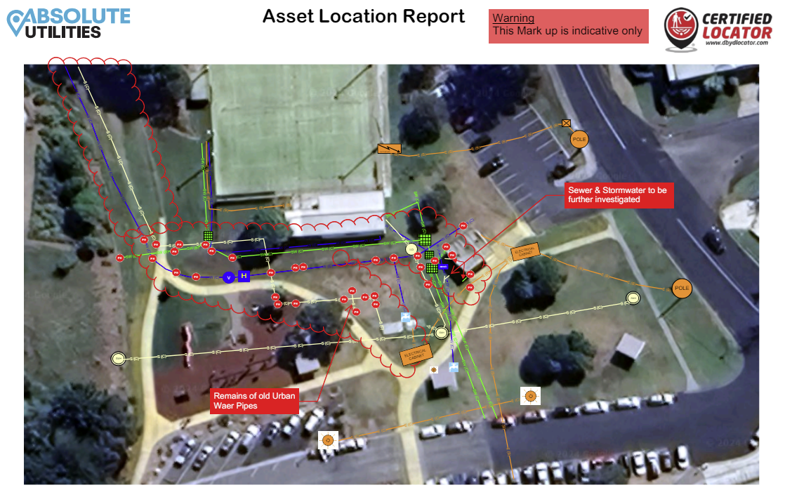
“It was an old toilet block, therefore there were a lot of redundant pipes and live assets within a congested area. I had to plot their locations onto aerial images for client reference,” Morrison said.

“Upgraded path lighting is to be installed, therefore the client needs to know the best place to fit the new underground electrical cables and poles in-between existing assets and design.
“Bluebeam is a really useful tool for projects when the client hasn’t requested a survey. My clients love the quality of digital reporting that it lets us provide, and they aren’t going to want to go back to the old dockets and hand draw diagrams.”
Find out more about Bluebeam’s end-to-end software for construction and design professionals.