Words by Paul Merrill
A bushfire can sweep through wooded areas and grassland at 25 km/h, with burning embers blown up to 40 km ahead of the flames by gusting winds. In hot, dry conditions, a mere 10-degree elevation can double the velocity of spread to faster than Usain Bolt’s record-breaking sprints.
But the most dangerous meteorological event for firefighters battling an out-of-control blaze or residents fleeing their homes isn’t necessarily an 83 km/hr gale. It’s a sudden and unexpected change in the gale’s direction caused by an approaching weather front. When that occurs, the fire intensifies as it begins a new path of destruction, potentially putting communities previously thought safe in immediate peril.
For fire service control centres, quickly and effectively communicating accurate data to crews on which areas are most at risk is critical to getting the fire under control and saving lives.
And that has just been made easier by a groundbreaking software platform developed by Australian engineers at Nova Systems for the NSW Rural Fire Service (RFS) that revolutionises how aerial photography of wildfires is captured, processed and delivered to control rooms.
The Airborne Intelligence Gathering (AIG) solution is a cloud-based geospatial application that uploads composite thermal images and instantaneously works out if they are the latest scan of a fire already being assessed or the first image of a new fire.
“It’s cut the time it takes for our multispectral scans to be processed and served up to operators from 30 minutes to around two minutes,” Chief Superintendent Chris Ryder, the NSW RFS Manager Aviation Operations, told create. “Before we had the AIG, it was very much a manual process. Someone would spot it in their inbox and send it to be checked and validated before uploading the massive files into the system.
“Half an hour is a lifetime when you’re battling a fast-moving fire. The wind may have shifted, or the flames may have jumped a road or be spreading over a new area that’s putting residents literally in the line of fire.”
The NSW RFS is the world’s biggest volunteer fire service, with 71,234 members in 1994 brigades responsible for protecting 760,000 km² – 95 per cent of the state. Its volunteers attend an average of 80 incidents a day, with most concentrated in the summer months.
The most challenging time in its 27-year history was the Black Summer of 2019-20 when fires decimated 5.5 million ha in NSW alone, destroying 2448 homes and killing 26 people, including three RFS volunteers. Throughout that December and January, the RFS’s fleet of firefighting planes, which includes a 737 Large Air Tanker and a Lockheed C-130H Hercules, together with several other aircraft leased by the organisation, flew up to 600 missions a day.
In 2021, the RFS extended its aerial scanning capabilities with two Cessna 560 Citation V jets, each equipped with a smart sensor camera containing powerful processing architecture made by US firm Overwatch Imaging. It takes infrared snapshots across a range of wavelengths, and standard RGB images, at altitudes of up to 6000 m and combines them to map fires in real time.
Nova Systems, an engineering software and technology company with offices in Australia, New Zealand, England, Singapore and Norway, was brought in to put the final – and most crucial – piece of the jigsaw puzzle into place so images could be delivered in record time.
“It’s a sophisticated piece of software that we had to build from scratch because nothing else like it existed,” Nova Systems’ Senior Software Consultant Ian Reid, a former Bushfire Analyst at NSW RFS, said.
The Nova systems software takes multiple images (RGB, LNV, infrared), knitting them together to give a comprehensive overview of a fire. Images: supplied
“Getting the composite scans into the RFS’s emergency management common operating picture (EM-COP) and making them available to operators with situational awareness data so quickly hadn’t been done before due to some complex challenges.”
The solution involves transferring each scan to an Amazon Web Services S3 bucket where they are translated into a cloud-optimised geoTIFF with embedded georeferencing. Scans are then loaded into a GeoServer image mosaic and made available via web mapping services. This means users can access the relevant data without having to wait for entire files to download.
“Two or three scans of a particular fire may be taken in a single day to track its progress,” Reid said. “For each flypast, the camera takes multiple images that are stitched together to display the necessary intelligence.”
Nova Systems is a long-term software solution development and support partner to the NSW RFS and has previously partnered with them to build, upgrade and support applications and platforms including a smoke modelling system, software to monitor weather patterns and a portal for bushfire management. It also helped update the Australian Fire Danger Rating System (AFDRS), which alerts communities to bushfire risk, with more sophisticated ways to process and display warnings based on eight fuel models instead of two.
Nearly half of the 50 biggest fires during the 2019-20 bushfire season coincided with cold fronts across south-eastern Australia, a 2023 study by the University of NSW and Australian National University found.
“Before a cold front passes, it will typically draw hot and dry north-westerly winds from Central Australia to the region,” Professor of Bushfire Dynamics Jason Sharples said. “This can dry out fuels and lead to more dangerous fire weather. As the front approaches, winds get stronger and can abruptly change direction, which can change the size and shape of a fire front and lead to erratic fire behaviour.”
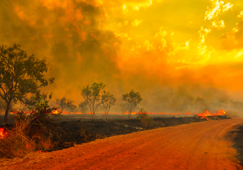
The researchers warned that such cold fronts have become more frequent and are likely to cause hotter and longer heatwaves and more devastating bushfires.
The AIG has already been a game-changer, but Reid is confident that its functionality can be further exploited.
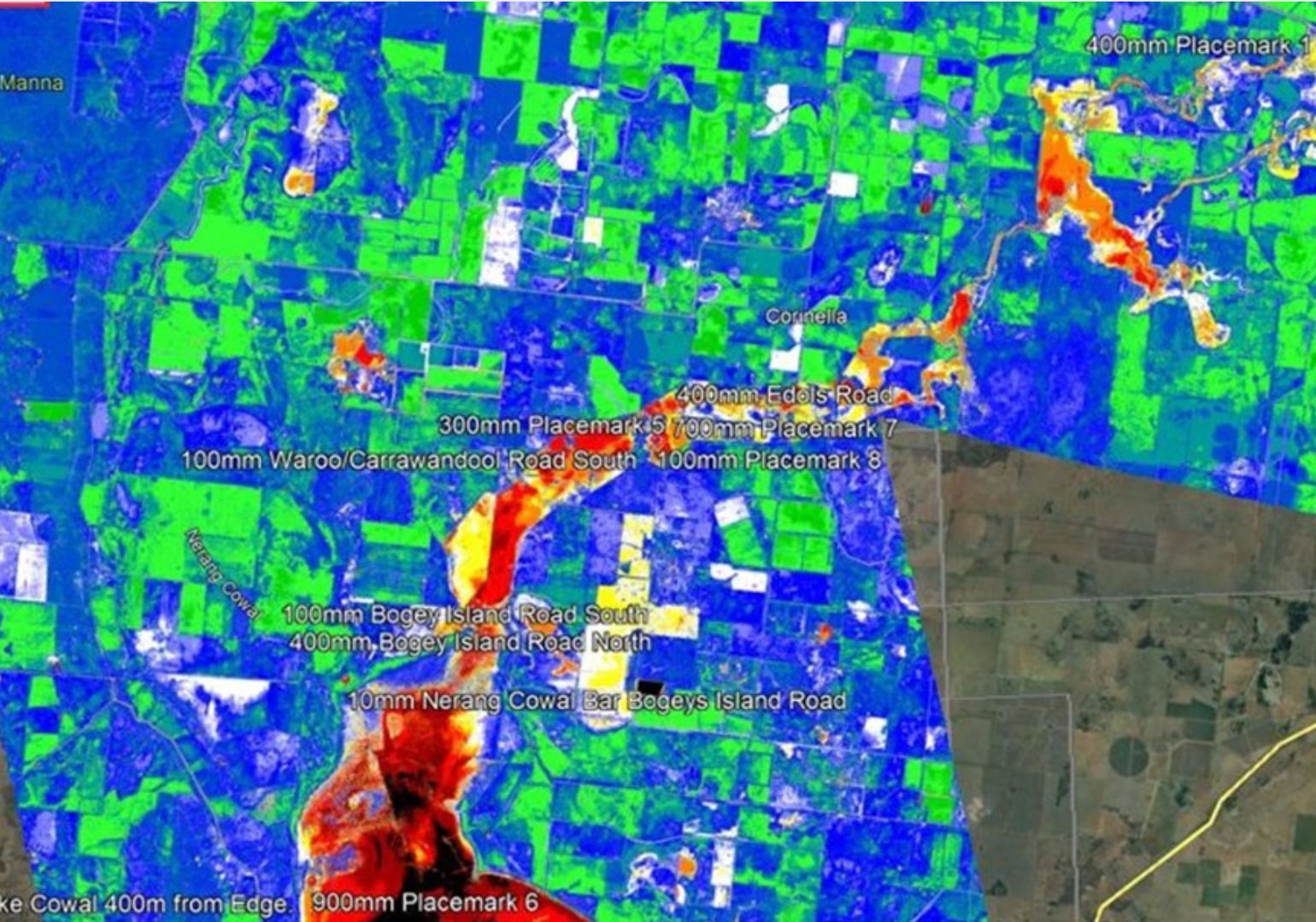
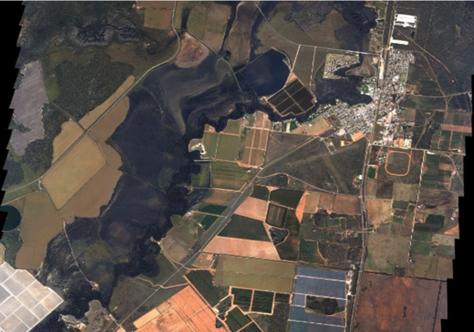
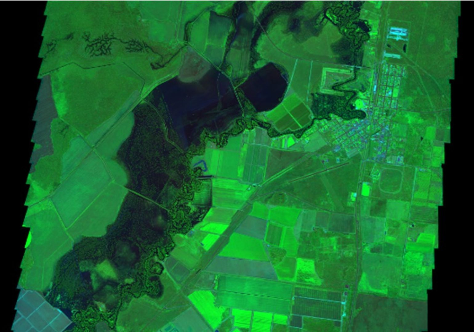
“The RFS has told us we’re probably using only five per cent of its capability at the moment,” he said. “The thermal composites currently show the here and now, an outline of the fire’s boundary and the areas that have been burnt. But there are more stories it could be telling us such as why it flared up in the first place and what caused its behaviour. We could use it to scan vast swathes of bushland and predict how future fires might spread.”
Some of this is already being done, but only two years’ worth of data has been collected so far, which isn’t enough to make the predictive simulations as accurate as they need to be.
“Once we’re able to build up a bigger catalogue of images, they can be fed into AI-powered fire behaviour models that will enrich the data and turn it into useful intelligence,” Reid said. “Then we’ll be able to assess how quickly a particular blaze is likely to move across different landscapes or types of vegetation in a range of weather scenarios.”
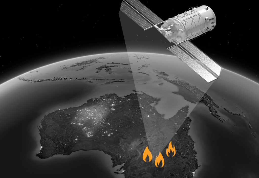
Nova Systems and the RFS are also collaborating to look at how satellite images or drone footage could be integrated into the RFS system and whether live video or georeferenced laser photography could be ingested.
“At present, they’re processed in a different application,” Ryder said. “But if we can stream the feeds from our helicopters and planes straight into our software, then firefighters may be able to watch live aerial views on their phones to react immediately to changing circumstances. That will make their jobs safer and easier.”
At this free Society of Fire Safety seminar, you’ll be able to learn the importance of holistic performance-based fire safety engineering design.
This article was originally published in the February 2025 issue of create with the headline “Quick fire response”.