

Technology company Nearmap is pioneering new ways for engineers to gather location intelligence across large infrastructure projects.
Once its innovative camera sensors capture multidirectional aerial views, the data goes through a sophisticated processing pipeline to develop high-resolution imagery and 3D datasets invaluable for design and construction. Now, the company is further expanding its partner integrations to offer a more natural extension to an engineer’s workspace.
The past few years have seen significant advances in how engineers, architects and construction firms view and integrate geospatial data into their project applications. From collaborating in virtual or augmented reality with building information modelling (BIM) to creating virtual simulations for digital twins and incorporating real-time data into existing workflows, geographic information system (GIS) technology is used to better understand and visualise our built world.
“By matching our extensive data with new visualisation techniques and project workflows, we can help anyone better understand the spaces engineers and architects are designing and developing. It makes it easier for firms to win new projects and discuss ongoing developments at project sites,” said Angela Catalan, Director of Global Product Marketing at Nearmap.
US infrastructure solutions firm HNTB, a Nearmap customer, is one example of how things have progressed. The company now hires game designers to partner with engineers to build innovative ultra-realistic visualisations leveraging Nearmap vertical and oblique aerial imagery. HNTB uses the data to accurately measure project sites and surrounds to rapidly create 3D prototypes in game engines while also adding high-resolution visual textured mesh to their GIS systems. The firm regularly competes against much larger organisations with bigger art departments, but finds that their innovative approaches are not only more efficient — they’re more effective at winning new business too.
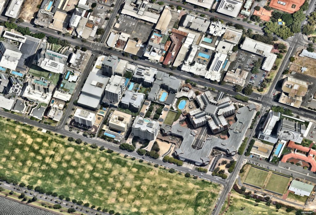
The quality, reach and efficiency of Nearmap data is unmatched in the market, although several competitors are attempting to make their mark in the space. Nearmap captures high-resolution imagery of more than 90 per cent of Australia’s population, 70 per cent of the US population and 75 per cent of New Zealand’s population and has a global customer base. Its powerfully advanced image processing pipeline turns around the data within days for customers to use. With a consistent regular capture every few months, Nearmap provides a bank of historical imagery and data that stretches over 14 years for engineers to draw on.
“Locations change with time, from influences such as changing watercourses, the impact of erosion, or the increasing density of population growth,” said Catalan. “With our data, you can see the impact of those changes in 4D, helping to map out not only the path of current change from a reliable source of truth but also predict how those changes could continue into the future.”
Recently, Nearmap has focused on expanding its strong partnership ecosystem to include more built-in workflows and platform integrations across its technology partners. For engineering, design and construction applications, these partners include Bentley Systems, Autodesk, Cesium and Esri, of which Nearmap is a Gold Partner.
Beyond its regular proactive survey program, Nearmap also captures imagery immediately following major catastrophes. This gives architects and engineers a deeper understanding into how major floods, fires, hurricanes and other severe weather events have affected a location.
During the devastating 2019-20 bushfire season, Nearmap captured more than 28,000 km2 of post-catastrophe imagery across Australia, helping to provide rapid insight into the impact of damage. This service helped speed up insurance claims by confirming affected locations and damage estimates without the need for physical site visits, helping communities recover faster.
Throughout the COVID-19 pandemic, Nearmap imagery has also replaced the need for many physical site visits for ongoing infrastructure projects, particularly larger complex projects that involved multiple stakeholders and land acquisition like freeway, metro and tunnel works. With 2D and 3D data sets, engineers can easily assess elevation profiling, add annotations and use the MapBrowser tool to access invaluable site information based on accurate and recent data.
Nearmap innovative workflows and services were recognised in 2020 when it was placed in the Top 10 Most Innovative Companies by Fast Company.
“Since launching our AI capability last year, we’ve had a lot of interest from a wide range of businesses wanting to use our dataset to add depth to their workflows. This includes aspects like detecting solar panels or pools for utility load modelling, detecting pervious and impervious surfaces for flood modelling, or measuring tree canopy for vegetation management. The feedback has been really positive and we’re really excited to see what’s next for our technology,” said Catalan.
To learn more about how Nearmap can enhance your workflows, you can connect with our team at view.nearmap.com/engineers-australia