CREATE
  • Technology
    • BIOTECH
    • COMMUNICATIONS
    • COMPUTING
    • IMAGING
    • MATERIALS
    • ROBOTICS
    • SOFTWARE
  • Industry
    • DEFENCE
    • INFRASTRUCTURE
    • INNOVATION
    • MANUFACTURING
    • POLICY
    • PROJECTS
    • TRANSPORT
  • Sustainability
    • ENERGY
    • ENVIRONMENT
    • RESOURCES
  • Community
    • CULTURE
    • PEOPLE
  • Career
    • EDUCATION
    • INSPIRATION
    • LEADERSHIP
    • TRENDS
  • About
    • CONTACT
    • SUBSCRIBE
No Result
View All Result
CREATE
No Result
View All Result
Home Industry Projects

Floodplain engineer is bringing unique expertise to urban planning

Jonathan Bradley by Jonathan Bradley
26 July 2022
in Projects
3 min read
0
Floodplain engineer is bringing unique expertise to urban planning

Flood engineer Carrie Dearnley has developed a system to help city planners better understand how to keep communities safer as they face increasingly dangerous floods.

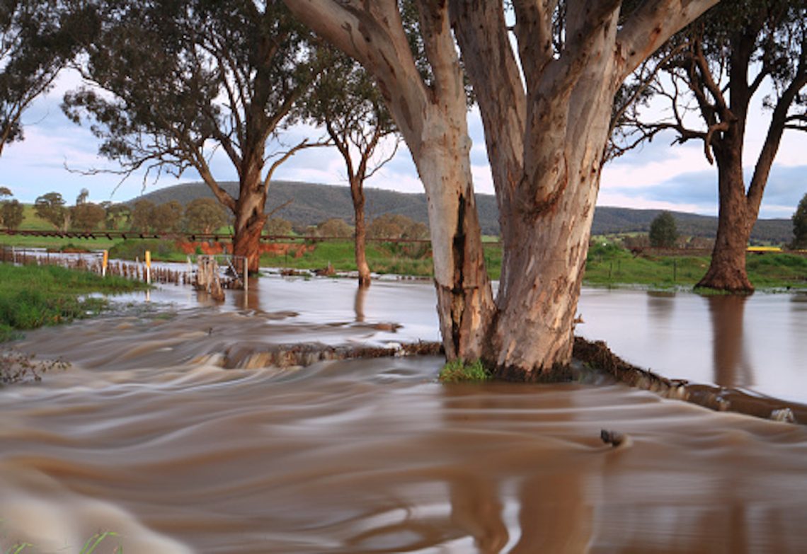
The flooding that engulfed parts of northern New South Wales and South-East Queensland this year has focused the country’s attention on helping communities become resilient against extreme weather.

Flood engineer Carrie Dearnley

Carrie Dearnley, Associate Principal Flood Engineer at BMT, is addressing this challenge by bringing expertise in floodplain management to urban planning.

Her work is called risk-based planning, and it allows the land-use planners she works with to better respond to flood risk by understanding more precisely which parts of a flood-susceptible area are safe to build on, and which are more dangerous than might be supposed.

“There wasn’t a lot of nuance in the way that flood model outputs were used in land-use planning,” Dearnley tells create. “There was a lot of information that was being missed.”

Earlier approaches to flood modelling would consider a certain likelihood of flooding – a one in 100 probability flooding event, for instance – and apply that to determine where it was and was not appropriate to build housing and other high-risk structures, such as schools or aged-care facilities.

Dearnley’s work, however, uses a risk-assessment matrix to consider a broader range of flood probabilities and hazards so higher and lower-risk zones can be identified.

“There wasn’t a lot of nuance in the way that flood model outputs were used in land-use planning. There was a lot of information that was being missed.”
Carrie Dearnley

“I developed the assessment process on a project for Toowoomba Regional Council – they were hit very badly in the 2010-2011 floods,” she recalls.

“They wanted to do a planning scheme update to better capture their new understanding about flood risk. So … I went back to the advice given in the Queensland Floods Commission of Inquiry, and also the state planning policy.”

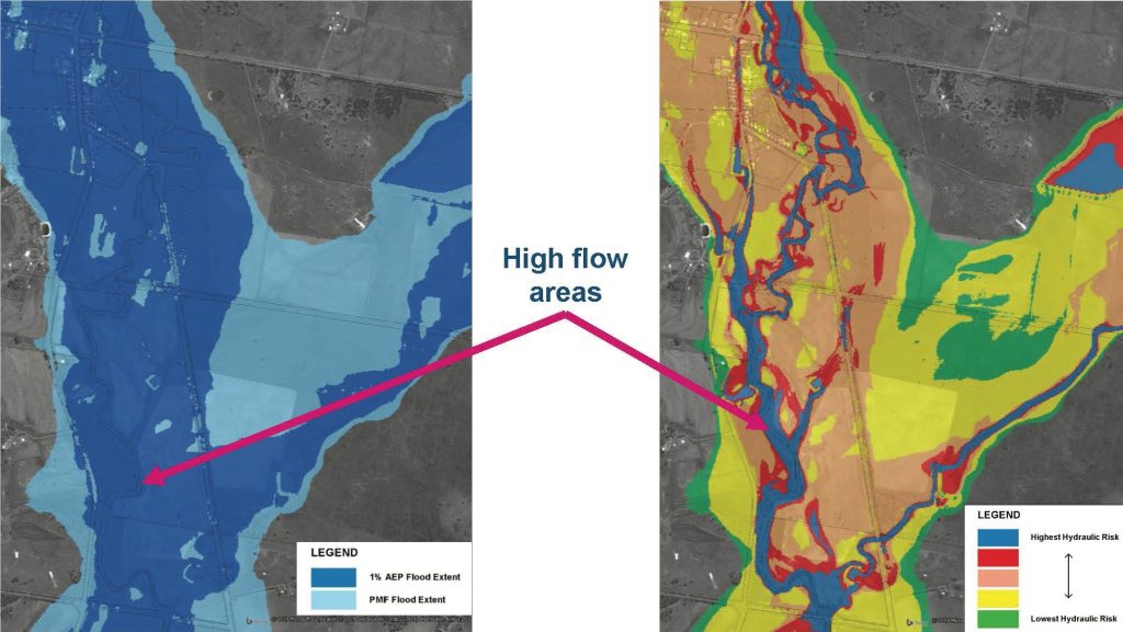
The inquiry’s advice recommended maps with bands of risk showing a flood’s likelihood and probable behaviour.

“But when you look at the mapping that’s typically provided with a flood study, it would be a huge book of maps that will say, ‘for a one per cent flood, here’s the velocity; for a one per cent flood, here’s the depth; for a one per cent flood, here’s the hazard. And now for a two per cent flood, here’s all those things again,” Dearnley explains. “It wasn’t a synthesis of the risk.”

That made it impossible, for instance, to compare an area of medium hazard in a rare-flood zone with a low hazard in a frequent-flood zone.

Dearnley calls her process of bringing together the variety of maps a “classic risk-assessment process”. She designated the outcome of a flood likelihood multiplied by the flood hazard as “hydraulic risk”, which enabled her to understand a flood’s behaviour as well as how affect people and property in its path.

The established method of flood-risk mapping (left) and Dearnley’s new approach (right).

“In the world of flooding, there are hazard definitions, which are based on the depth and velocity of the water and are linked to a consequence through lab experiments,” she explains.

“These definitions relate flood hazards to impacts such as risk, when cars start floating, and if buildings get damaged.”

All that information then goes into a risk matrix, which can be expressed in terms of colour bands on a map.

“This is really about looking forward and improving it in terms of green field areas – so developing in new areas – but also in brown field: if you’re redeveloping a site, [you’re] making sure that the new development is fit-for-purpose and risk-appropriate,” Dearnley says.

“What it really does is it equips planners with a lot more information. The information was always there, but … planners weren’t able to pick up a flood study and know how to use all the information. 

“What it really does is it equips planners with a lot more information. In some ways, it’s a communication tool, synthesising information in a way that planners need.”
Carrie Dearnley

“In some ways, it’s a communication tool, synthesising information in a way that planners need.” The approach can also be adjusted to take into account the greater flood risks that can result as the effects of climate change increase. 

“In this kind of process, what we have done in the past is repeat this mapping using modelling which has a climate change allowance on it – which can be increased rainfall intensity and sea levels,” Dearnley says. 

“And then you can show the difference in the mapping, so you can say, ‘Previously there were 100 houses in this highest hydraulic risk band. In the future, we expect there’ll be 150 in that risk band.’ 

“So you could say ‘These are houses which are newly at risk, and these other houses are likely to have increased risk in the future.’”

Tags: risk managementurban planningindustry newscity planningflood management
Previous Post

Infographic: Engineering the Tour de France

Next Post

Australian mine trials underground EV charging

Jonathan Bradley

Jonathan Bradley

Jonathan Bradley is a staff writer whose work has appeared in The Sydney Morning Herald, The Age, ABC News, SBS and Billboard. As well as engineering, he likes to write about politics, pop music, culture and cartoons.

Next Post
Australian mine trials underground EV charging

Australian mine trials underground EV charging

Leave a Reply Cancel reply

Your email address will not be published. Required fields are marked *

    WANT CREATE DELIVERED DIRECT TO YOUR INBOX? SUBSCRIBE TO OUR NEWSLETTER.

    By subscribing to create you are also subscribing to Engineers Australia content. Please find our Terms and conditions here

    create is brought to you by Engineers Australia, Australia's national body for engineers and the voice of more than 120,000 members. Backing today's problem-solvers so they can shape a better tomorrow.
    • ABOUT US
    • CONTACT US
    • SITEMAP
    • PRIVACY POLICY
    • TERMS
    • SUBSCRIBE

    © 2024 Engineers Australia

    No Result
    View All Result
    • Technology
      • BIOTECH
      • COMMUNICATIONS
      • COMPUTING
      • IMAGING
      • MATERIALS
      • ROBOTICS
      • SOFTWARE
    • Industry
      • DEFENCE
      • INFRASTRUCTURE
      • INNOVATION
      • MANUFACTURING
      • POLICY
      • PROJECTS
      • TRANSPORT
    • Sustainability
      • ENERGY
      • ENVIRONMENT
      • RESOURCES
    • Community
      • CULTURE
      • PEOPLE
    • Career
      • EDUCATION
      • INSPIRATION
      • LEADERSHIP
      • TRENDS
    • About
      • CONTACT
      • SUBSCRIBE
    preload imagepreload image