
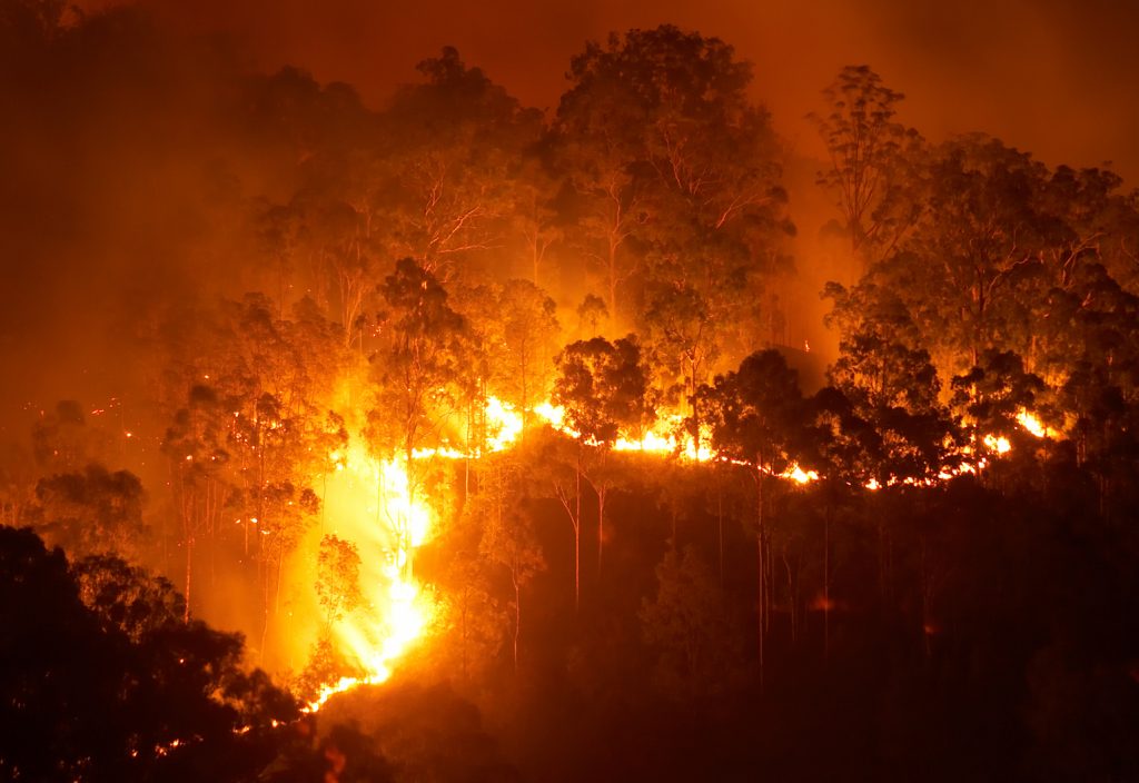
Australian-designed instrumentation is providing the smarts for a high-resolution camera that will help monitor bushfires and other natural disasters from space.
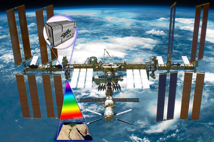
The hyperspectral camera – known as the DLR Earth Sensing Imaging Spectrometer (DESIS) – was launched aboard a SpaceX Falcon 9 rocket and installed on the International Space Station (ISS). It will monitor global natural disasters, bushfires and environmental changes on Earth.
The camera is the result of a three-year collaboration between the German Aerospace Centre (DLR) and La Trobe University’s Department of Engineering – a commercial project believed to be the first of its kind for an Australian university.
According to Dr Peter Moar, the university’s project lead, DLR tasked La Trobe’s engineering team to create advanced on-board systems for DESIS that manage the critical handling of image data and storage.
“It’s been an amazing experience to help create such an advanced space-qualified instrument that must also deliver commercial outcomes. In terms of its intended performance, it’s one of the first of its kind in the world,” he explained.
Moar said this achievement highlights three decades of expertise in designing and developing advanced electronic systems for hazardous environments within the department’s award-winning TIGER Radar research team.
“It also cements Australia’s position as world-leaders for space research and engineering, reinforced most recently with the establishment of an Australian Space Agency,” added Moar, who is also the Chair of Engineers Australia’s National Committee for Space Engineering.

Game-changer, life-saver
Victorian Minister for Industry and Employment Ben Carroll called DESIS a “game-changer”, stating that it could monitor conditions on Earth from 400 km away in outer space.
Moar explained that as the instrument passes over its target, a sequence of photos at varying angles will be captured and processed by sophisticated on-board processing – providing images that were previously impossible to generate.
This technology will assist government and emergency services in Australia and around the world, Moar said.
“It will help save lives and minimise damage to property and infrastructure by providing timely images of natural disasters such as bushfires and floods, as well as detecting the rate of global deforestation and water quality levels around reef bodies such as the Great Barrier Reef,” he explained.
DESIS will transmit data to La Trobe’s Engineering Department and Melbourne-based industry partner ESS Weathertech.
As part of the ongoing collaboration between La Trobe University and DLR, ESS Weathertech has established a ground station to receive data directly from DLR’s FIREBIRD satellite constellation, which measures and maps high-temperature events on Earth using visible wavelengths as well as infrared technology.
Moar has previously explained that data from the FIREBIRD satellites and DESIS instrument, in combination with additional satellites expected to be launched in the next five to eight years, will provide equivalent mapping to the Bureau of Meteorology’s rain data, “but for fires”.
International commercial collaborations such as the partnership between Latrobe and DLR will be key to expanding Australia’s slice of the multi-billion dollar global space sector. The head of Australia’s new Space Agency, Dr Megan Clark, recently stated that a tight focus on industry will allow us to “run through the legs of giants”.
“The collaboration between La Trobe University and DLR is a perfect example of doing just that,” Moar said.